Have you ever wondered whether modern modeling can spot risks before they become disasters?
You will get a clear view of why AI in climate change matters now and how it helps turn vast datasets into timely decisions that affect your community and the planet.
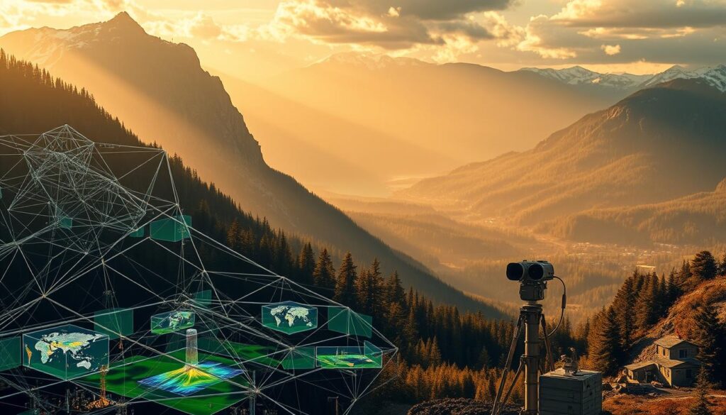
Massive environmental datasets take years to collect and analyze. New tools speed that work, improve forecasts, and help deploy mitigation earlier. Satellites, smart grids, and materials research already show real impact across energy, transport, and agriculture.
Trust and assurance in models shape policy. You will learn how modeling highlights uncertainty, strengthens observation programs, and guides public decisions you care about.
At the same time, computing has an energy cost. You will weigh those trade-offs and see where research networks and public-private efforts are driving the most promise for the United States and the world.
Key Takeaways
- You will understand why advanced modeling is essential to act earlier and smarter.
- Data volume and variety require new tools to turn numbers into decisions.
- Trustworthy models reduce uncertainty and improve policy outcomes.
- Technology helps across energy, transport, agriculture, and observation systems.
- Compute demands have an emissions cost that you should weigh objectively.
Why AI Matters Now for Climate Change in the United States
Policymakers need faster insight to protect systems and communities from mounting weather risks. Processing vast datasets shortens the time between observation and action, so you can fund repairs, reroute power, or release health alerts sooner.
- Grid reliability and extreme weather: Faster models help you anticipate outages and prioritize upgrades for critical assets.
- Researchers and agencies: Use data-driven systems to flag risks early and guide investments in resilient infrastructure.
- Regional forecasts: Improved prediction helps you allocate emergency resources where they will matter most.
- Energy efficiency: Smarter demand forecasting and renewables integration support U.S. decarbonization goals and cut emissions.
- Reduced waste: Optimized logistics, buildings, and public works lower costs and improve the environment.
- Evidence-based research: Builds confidence for federal, state, and local decisions and magnifies policy impact.
Earlier detection and targeted response can reduce economic losses and health harms from heat, floods, and smoke. These tools help you focus resources where they do the most good while supporting ongoing research and practical efforts across the country.
Your Search Intent: What You’ll Learn About AI’s Climate Impact Today
You need clear, practical guidance to judge which models will help your organization make better resilience choices today.
What this section gives you: a concise way to assess model value, realistic benefits to expect now versus soon, and how research and observation feed better forecasts.
You will see concrete use cases across forecasting, disaster analysis, energy optimization, agriculture, and remote monitoring. Each example shows how data and model outputs map to decisions you can act on.
- How to read outputs and uncertainty bands so you make informed risk choices.
- Which data sources matter most and how to check their coverage and quality.
- How to combine model insight with domain expertise to avoid overreliance.
| Focus | Now | Near future |
|---|---|---|
| Forecast reliability | Improved short-term | Higher resolution |
| Observation feedback | Better data use | Expanded sensors |
| Decision impact | Operational wins | Strategic planning |
By the end you will have a short checklist to align expectations with current model capabilities and the likely trajectory over the next few years.
From Data to Decisions: How artificial intelligence turns climate data into action
Good decisions need fast, reliable data pipelines that link observation to action. You will see how faster processing and targeted measurements make model outputs useful for day-to-day choices.
Big data, faster models: shortening time-to-insight for policymakers
Faster models cut the time between observation and response. Shorter time-to-insight helps you prioritize repairs, issue alerts, and route resources where they matter most.
Trusting predictions: model assurance, uncertainty, and better observation programs
You will learn how to audit uncertainty and quantify risk before you operationalize predictions for the environment. Targeted observation campaigns close error-prone gaps and feed verifiable improvements back into models.
- You will learn how to audit uncertainty and quantify risk before operationalizing predictions in environmental contexts.
- You will see how targeted observation campaigns close error-prone regions and feed verifiable improvements back into models.
- You will understand governance patterns—peer review, benchmarks, and red-teaming—that increase confidence in outputs you depend on.
- You will explore how to communicate uncertainty ranges clearly to nontechnical stakeholders so action is appropriately calibrated.
- You will identify recurring challenges in climate model deployment and how to mitigate them with transparent methods.
| Need | Action | Outcome |
|---|---|---|
| Uncertain forecast | Audit error bands | Calibrated response and lower risk |
| Data gaps | Targeted observation campaigns | Improved model skill |
| Governance | Peer review and benchmarks | Stronger trust and adoption |
ai in climate change: the present-day landscape and momentum
A growing network of research programs and funded initiatives is lowering barriers for pilots and practical solutions. You can tap grants, cloud credits, and shared datasets to test ideas faster and at lower cost.
Key domains seeing impact
Energy, transportation, agriculture, oceans, and space all show near-term potential. Each sector uses models and operational tools to cut waste, improve forecasts, and speed responses.
Notable initiatives and research networks
- Microsoft AI for Earth ($50M) funds tools and datasets that de-risk pilots.
- Google AI for Social Good supports 20 organizations with credits and mentorship.
- Academic and network programs: ELLIS ML for Earth and Climate Sciences, iMIRACLI PhD training, and Climate Change AI coordinate global research.
- ESA’s Digital Twin Earth links observations to model testing at scale.
| Program | Support | Practical Benefit |
|---|---|---|
| Microsoft AI for Earth | Funding, tools | Lower cost pilots |
| Google AI for Social Good | Cloud credits | Faster experimentation |
| ESA Digital Twin Earth | Data integration | Improved model testing |
You will identify trusted sources and partners, learn how to collaborate with global research teams, and see how grants and credits reduce early risk. These efforts align with U.S. priorities and can speed real-world impact across the world.
Remote monitoring at scale: satellites, drones, and autonomous systems
Long-duration platforms are closing gaps where seasonal access is impossible, so your models keep running when ships must pull back.
Air, water, and ecosystem health: continuous sensing for early warnings
Continuous sensing preserves critical time series that feed forecasts and alerts. You get earlier signals for harmful algal blooms, air quality shifts, and water temperature anomalies.
Real-time indicators and anomaly detection
Networks of satellites and drones provide broad coverage while robotic platforms fill local gaps. Continuous records let anomaly detectors spot trends that single surveys miss.
Closing observation gaps with long-duration autonomous robots
In the Arctic, winter ice forces ships to depart and creates data gaps. Autonomous robots can operate for up to six months to collect observations that support research and seasonal prediction.
- You will learn how long-duration autonomous systems keep critical time series intact in harsh environments.
- You will understand the power constraints and reliability engineering needed for months-long deployments.
- You will see how filling observation gaps reduces model bias and improves seasonal outlooks.
- You will explore mission planning that balances number of platforms with coverage and cost.
| Platform | Typical Duration | Primary Benefit |
|---|---|---|
| Satellite constellation | Continuous | Broad coverage and frequent revisit |
| Long-endurance drone | Days to weeks | Targeted aerial surveys |
| Autonomous robot (marine/ice) | Up to 6 months | Local time series during seasonal gaps |
Weather forecasting and climate modeling advancements
Modern forecasting links many observation streams to deliver faster, more accurate predictions you can act on.
AI fuses satellite and surface observations with model predictions, and automated labeling plus improved approximations raise performance across systems as the number of inputs grows.
Short- and long-range forecasts powered by enhanced models
Short-range forecasts gain from rapid assimilation of new measurements. Long-range outlooks get better when models use richer historical records and smarter approximations.
Integrating more data sources for higher-resolution predictions
- You will learn how to blend satellite, radar, and in-situ data sources to increase forecast fidelity.
- You will see how scalable systems manage a growing number of inputs without degrading throughput.
- You will understand governance practices that keep data quality and provenance clear across providers.
| Capability | Benefit | Example |
|---|---|---|
| Assimilation | Faster updates | Satellite + surface data |
| Scalability | Consistent throughput | Cloud-native systems |
| Governance | Trusted outputs | Provenance tracking |
Disaster analysis and preparedness: earlier signals, smarter responses

Rapid detection and clear guidance help you act before events worsen. Faster analysis of path and exposure gives emergency managers the time to prioritize people and assets.
Hurricanes and wildfires: path, progression, and infrastructure risk
Models and sensors track likely routes and hotspots. That lets you map which roads, power lines, and facilities face the greatest exposure.
Evacuation timing, resource allocation, and damage mitigation
Decision tools optimize evacuation timing along major transportation corridors so you reduce congestion and speed safe exits.
- Evacuations: optimize routes and departure windows to cut clearance time.
- Energy support: prioritize generators and fuel for hospitals and shelters.
- Damage plans: stage crews and materials to reduce losses and speed recovery.
| Need | Action | Benefit |
|---|---|---|
| Clear routes | Timing + rerouting | Faster, safer evacuations |
| Critical power | Pre-deploy generators | Less downtime at facilities |
| Repair staging | Allocate crews by risk | Shorter recovery time |
Ongoing research and practical testing show real benefits for local systems and transportation planning. Use these tools to make faster, better decisions when seconds and resources matter most.
Resource and systems optimization: cutting waste, power use, and emissions
You can cut waste and lower costs by using scenario-led models that spot inefficiencies across systems. Start with simple stress tests that show where equipment, routes, or inventory create needless losses.
Manufacturing and industry: energy efficiency and process intelligence
Use short-run experiments to find high-impact fixes. Feed operational data into models that flag idle time, excess heating, and material waste.
Small changes in scheduling and control loops can cut energy use and lower emissions while keeping throughput steady.
Supply chains and emergency response: planning with predictive models
Stress-test your supply chain under multiple scenarios to quantify risk exposures. Scenario planning helps you preposition stock and crews before demand spikes or disruptions.
- You will learn how to stress-test your supply chain under multiple scenarios and quantify risk exposures.
- You will see how models optimize routing and inventory to reduce energy use and lead times.
- You will understand how to coordinate with public agencies to improve response outcomes when numbers of incidents rise.
| Domain | Primary Benefit | Example Action |
|---|---|---|
| Manufacturing | Lower energy use | Optimize shift timing and process setpoints |
| Logistics | Fewer miles, faster delivery | Route re-optimization for transportation fleets |
| Emergency response | Faster aid, less waste | Preposition supplies by predicted demand |
Coordinate with local research partners and agencies to validate outcomes. These efforts make systems more resilient and help the United States meet practical climate goals.
Agriculture and land use: precision decisions to reduce greenhouse gas emissions
Early detection systems let growers treat small problems before they become widespread. That reduces chemical use and preserves soil quality while protecting yields.
Soil, water, and fertilizer: targeted use for higher yields and lower carbon
Targeted inputs cut wasted fertilizer and lower emissions without hurting output. You can use sensor data to irrigate only when crops need water and apply fertilizer at precise rates.
Pest and disease detection: minimizing losses and inputs
Early alerts let you treat small patches rather than whole fields. This lowers chemical load on the environment and reduces crop loss risk.
- You will see how early detection models reduce risk and protect yields with fewer inputs.
- You will learn how researchers and scientists validate detection accuracy across environments.
- You will understand how to implement field-ready solutions that scale across crops.
| Focus | Benefit | Practical action |
|---|---|---|
| Soil moisture | Lower water use | Variable-rate irrigation |
| Fertilizer timing | Reduced emissions | Split applications based on soil tests |
| Pest detection | Fewer chemicals | Targeted spot treatments |
Energy and electricity: smarter grids, demand forecasting, and renewables
Buildings and rooftop systems are becoming active resources on the modern grid.
Grid stability depends on fast forecasts that reflect weather and shifting demand patterns. You can use short-term predictions to balance load, schedule reserves, and avoid costly outages.
Grid stability and load balancing as weather and demand patterns shift
Operators combine weather data, meter reads, and operational constraints to keep frequency and voltage steady. Better models let you dispatch flexible assets faster and reduce the need for spinning reserves.
Forecasting building energy use and integrating distributed sources
Studies show that forecasting occupancy, weather, and equipment behavior improves building energy use predictions. You will see how models let rooftop PV, batteries, and EVs act as a coordinated resource.
- You will see how to model occupancy, weather, and equipment to predict building energy use.
- You will understand how to integrate rooftop PV, batteries, and EVs into a flexible resource.
- You will learn how forecasting reduces emissions and bills simultaneously.
| Capability | Benefit | Example |
|---|---|---|
| Load forecasting | Fewer outages | Short-term dispatch |
| Distributed resource aggregation | Lower peak demand | Rooftop PV + batteries |
| Building models | Lower bills | Predictive controls |
Oceans and cryosphere: understanding heat transfer and rapid change
Understanding how the sea and ice move heat helps you anticipate rapid shifts in coastal risk. Oceans store and move energy across seasons. Melting ice alters circulation and local conditions that models must capture.
Autonomous observation in hard-to-reach environments
Autonomous floats, gliders, and winter-capable robots collect year-round data where ships cannot operate. These platforms deliver temperature, salinity, and gas flux measurements during frozen months.
That continuous record cuts uncertainty for areas that were once data-sparse. You get more reliable inputs for operational models and for research planning.
Modeling ocean responses and filling winter data gaps in the Arctic
Combining satellite and in-situ sources with models reveals how heat content and circulation change. Better winter coverage reduces seasonal biases that skew forecasts and risk assessments.
You will learn how integrated sources close key uncertainties in ocean heat content and circulation. You will see how improved winter data reduces biases in models used for climate risk planning. You will understand how gas exchanges and conditions factor into carbon accounting for oceans.
| Focus | Benefit | Practical output |
|---|---|---|
| Year-round in-situ | Fills winter gaps | Reduced model bias |
| Satellite fusion | Broad coverage | Improved circulation maps |
| Gas flux measures | Better carbon estimates | Accurate ocean carbon budgets |
Space-based intelligence: monitoring forests, fires, and emissions
Space sensors deliver continuous sightlines that reveal subtle land and gas signals you can act on. These feeds link orbiting platforms to models that predict risk and surface anomalies early.
Satellite data fusion: linking observations with model predictions
Aligning sources and models makes satellite data actionable for field teams and emergency managers. You will learn how to set up consistent feeds so alerts match operational needs.
Systems and latency: making feeds time-sensitive
Keep latency low with clear systems engineering. Short delays let you track plume drift and fire spread and trigger mitigations sooner.
- You will learn how to align satellite sources and models for consistent, actionable feeds.
- You will see how systems engineering keeps latency low for time-sensitive operations.
- You will understand how gas plumes and land signals translate into mitigation actions.
| Source | Latency | Primary value |
|---|---|---|
| High-resolution optical | Hours | Map burned area, tree stress |
| Spectral sensors | Hours | Detect vegetation health |
| Gas monitoring | Minutes to hours | Track plumes and emissions |
Link these feeds with local networks and research partners to reduce surprise and improve response. Doing this helps your team turn raw data into timely, trusted action.
Transportation and mobility: electrification, routing, and last-mile solutions
Routing, charging, and vehicle type together decide the true benefit of modern mobility pilots. You will see practical ways to pair electric fleets with smarter charging and routing so energy use drops while service stays reliable.
EV charging architecture and fleet optimization
Fast and smart charging reduces downtime and spreads demand to lower peak costs. You can test scenarios that stagger charging windows and pair depot chargers with on-route top-ups.
Reimagining last mile: drones vs. delivery vans for lower emissions
Replacing some van routes with drones may reduce fuel and emissions depending on geography and load profiles. Use research-backed simulations to find where drones help and where ground fleets remain better.
- You will see when drones reduce emissions versus traditional vans and when they do not.
- You will learn how to run a scenario that balances service levels, safety, and neighborhood impacts.
- You will understand how to integrate drone operations with ground fleets for net gains.
| Option | Best use case | Primary benefit |
|---|---|---|
| Electric van | High-load, multi-stop routes | Lower operating emissions |
| Drone delivery | Light parcels, short hops | Reduced fuel per trip (where feasible) |
| Hybrid routing | Mixed loads, urban cores | Optimized service and energy use |
Ethical, social, and governance challenges you should weigh
When model outputs touch public policy, you must judge more than technical skill. Tools can improve response and planning, but they also introduce social risks that require oversight and public trust.
Bias, transparency, and fairness for model-driven decisions

Models can embed historical bias or data gaps that harm vulnerable groups. You should demand clear documentation of training data, assumptions, and known limits.
Predictive intelligence must be audited with diverse tests so outputs treat communities fairly and do not deepen inequity.
Assurance and accountability in high-stakes public policy
Assurance practices — versioning, audits, and independent review — make model use defensible. Accountability means assigning roles, logging decisions, and enabling redress when errors occur.
Governance should treat these systems as part of public infrastructure, not as opaque black boxes.
- You will learn how to detect and mitigate bias in climate-related models that influence public decisions.
- You will see why transparency and documentation are nonnegotiable for legitimacy and accountability.
- You will understand assurance practices that make models a trustworthy part of governance.
- You will weigh risks to communities and the environment alongside benefits before deployment.
| Element | Practice | Outcome |
|---|---|---|
| Bias detection | Holdout tests and demographic checks | Lower unfair impacts |
| Transparency | Open documentation and provenance | Public trust and better scrutiny |
| Assurance | Independent audits and incident logs | Clear accountability and safer use |
The carbon footprint of AI: balancing computational power and climate benefits
Estimating the true carbon cost of heavy computation requires comparing lifecycle emissions to the savings those systems enable.
You should measure server energy, cooling, and manufacturing emissions, then stack that against the operational benefits models deliver for energy, transport, and agriculture.
Energy use, processor efficiency, and emissions trade-offs
Modern processors vary widely in power draw and efficiency. Choose hardware that lowers runtime energy per inference and run fewer, better-scoped experiments to cut total impact.
Efficiency matters: optimizing code, using batch runs, and selecting near sources for compute reduce both cost and greenhouse gas output.
Measuring net impact: when gains outweigh greenhouse gas costs
Build end-to-end scenarios that trace emissions from manufacture to operation and compare them to avoided emissions from improved routing, reduced waste, or faster response.
- You will learn how to build scenarios and models that show net impact from end to end.
- You will see which use cases most reliably deliver benefits that exceed lifecycle greenhouse gas emissions.
- You will understand how to report results transparently so stakeholders can trust the conclusions.
| Use case | Typical lifecycle carbon | Net outcome |
|---|---|---|
| Grid load forecasting | Moderate | Often net negative (cuts fossil generation) |
| Precision agriculture | Low | Net negative (reduces fertilizer and water) |
| Large model research | High | Mixed — needs strong deployment benefits |
Report assumptions, energy sources, and sensitivity ranges. That transparency helps you and your partners judge when computational use truly reduces greenhouse gas emissions rather than merely shifting them.
Policy and investment signals shaping the future of climate AI
Policy choices and investment flows decide which research gets turned into real-world tools. You should watch funding priorities, standards, and co-funding models because they steer what solutions scale and where effort concentrates.
Evidence-based governance and standards for trustworthy systems
Standards that require audits, documentation, and performance metrics help you trust outputs. Clear governance reduces rollout risk and protects communities when models inform public action.
Public-private initiatives and research funding priorities
Programs like Microsoft AI for Earth and Google AI for Social Good show how grants and cloud credits accelerate pilots. European research networks provide examples of coordinated sources and shared protocols that the U.S. can adapt.
- You will identify co-funding models and sources that reduce early-stage risk.
- You will learn how to prioritize energy, water, and disaster resilience in funding calls.
- You will understand how to track the number of projects and measure outcomes.
| Signal | What it means | Practical outcome |
|---|---|---|
| Targeted grants | Focus on priority sectors | Faster pilots for high-potential solutions |
| Cloud credits | Lower experimentation cost | More trials and reproducible research |
| Standards | Common evaluation | Fewer surprises at scale |
How you can evaluate impact: metrics, scenarios, and risk levels
Start by measuring what matters: link model outputs to real-world hazards your community faces. Define clear, time-bound metrics that show whether interventions lower risk for people and assets.
Use data-driven indicators such as projected flood days avoided, reduction in outage hours, or percentage drop in fertilizer use. These tie model signals to outcomes funders and managers can verify.
Structure scenarios that stress key uncertainties. Run sensitivity tests on sea-level rise, storm frequency, or demand spikes so you see which assumptions change your prioritized actions.
- You will learn to define metrics that link model outputs to real-world risk reductions.
- You will see how to build scenarios that test sensitivity to uncertain variables.
- You will understand partnering with researchers to validate results using your data.
- You will learn to convert insights into decisions and track outcomes over time.
| Step | What to measure | Why it matters | Example metric |
|---|---|---|---|
| Define targets | Exposure and vulnerability | Aligns models with community needs | Days of flooding avoided per year |
| Run scenarios | Key uncertain drivers | Shows sensitivity and robustness | Performance across 3 sea-level scenarios |
| Validate | Local observations and trials | Builds trust for operational use | Observed vs. predicted outage hours |
Conclusion
Clear goals, transparent methods, and measured pilots are the best path to real-world results.
You will leave with a balanced view of how to apply intelligence responsibly and how to weigh benefits against social and carbon costs.
Focus your next steps where you expect the most potential — energy, disaster response, agriculture, oceans, or space — based on local needs and data.
Engage with research networks and governance partners to scale trusted solutions and document outcomes so others can learn from your efforts.
With evidence-based oversight and practical pilots, you can align your work with a future where benefits clearly outweigh emissions and risk, helping the planet and your community.
FAQ
What does artificial intelligence do for climate research and policy?
It turns large, messy datasets from satellites, sensors, and models into usable insights. You can use these insights to forecast extreme weather, optimize energy systems, and prioritize conservation actions. By shortening time-to-insight, you make faster, better-informed decisions for mitigation and adaptation.
Why does this matter now for the United States?
Rising heat, wildfires, and sea-level threats are raising costs for communities and infrastructure. You need tools that improve forecasting, reduce power waste, and guide investments. Advanced models and real-time monitoring help U.S. agencies and utilities manage risk and cut emissions more effectively.
What will you learn about the impact of intelligence on climate today?
You’ll learn practical uses—from better weather forecasts and smarter grids to precision farming and disaster response—and the trade-offs, like computational energy use and governance challenges. This helps you weigh benefits, risks, and where to focus action and funding.
How does intelligence convert raw climate data into actionable decisions?
Systems clean and fuse satellite, ground, and ocean measurements, then run fast predictive models. Those models quantify uncertainty, so you can allocate resources or change policy with clearer confidence. In short, you move from observation to operational choices.
How do faster models help policymakers?
Faster models reduce the lag between observation and decision. You can run more scenarios, test interventions, and update guidance in near real time. That improves emergency planning, infrastructure design, and emissions reduction strategies.
How do you know model predictions are reliable?
Trust comes from validation against observations, transparent uncertainty estimates, and independent audits. Robust observation programs—satellites, balloons, buoys—fill data gaps and improve model assurance so you can rely on outputs for high-stakes choices.
What sectors are seeing the biggest impact today?
Energy, transportation, agriculture, oceans, and space-based monitoring show rapid uptake. You’ll see smarter grids, predictive maintenance for fleets, precision crop treatments, and improved marine observations that inform fisheries and coastal protection.
Which initiatives and networks are accelerating progress?
Public-private partnerships, university consortia, and agencies like NOAA and NASA fund shared data platforms and model development. You’ll also find cross-sector efforts that standardize data and speed deployment of operational tools.
How are satellites and drones used for remote monitoring?
Satellites provide broad coverage for emissions, vegetation, and sea-surface temperature. Drones and autonomous robots fill in local, high-resolution gaps—monitoring reefs, wetlands, and disaster zones—so you get continuous, scalable sensing.
How does improved forecasting change disaster preparedness?
Earlier, clearer signals let you time evacuations, pre-position supplies, and protect critical infrastructure. Smarter forecasts reduce response costs and can save lives by improving timing and resource allocation.
How do predictive systems optimize resources and cut emissions?
They improve load balancing, detect inefficiencies, and optimize logistics. In manufacturing and supply chains, predictive models reduce waste and energy use. For grids, forecasting demand and renewables output lowers reliance on carbon-intensive backup power.
How can technology lower agricultural emissions while boosting yields?
Precision tools guide when and where to apply water, fertilizer, and pest control. You reduce input use and nitrous oxide emissions while maintaining or increasing yields. That supports both climate goals and farm economics.
What advances help grids handle variable renewables?
Demand forecasting, distributed resource coordination, and real-time control systems improve grid stability. These tools let you integrate more wind and solar without compromising reliability.
How does monitoring oceans and ice benefit climate science?
Autonomous sensors and improved models reveal heat uptake, circulation changes, and ice loss. That information refines sea-level projections and informs coastal planning and marine ecosystem management.
What role do satellites play in tracking forests and emissions?
Satellites detect deforestation, fires, and methane plumes at scale. When fused with ground data, they let you verify emissions reports, target enforcement, and measure the impact of conservation programs.
How are transportation systems becoming lower carbon?
Route optimization, fleet electrification planning, and charging-station forecasting reduce energy use and emissions. You can also evaluate trade-offs—like drone delivery versus vans—for last-mile impacts.
What ethical and governance issues should you consider?
Watch for bias, lack of transparency, and unequal access to tools. You should demand accountability, clear standards, and public oversight when models affect vulnerable communities or public policy.
Doesn’t running big models create a large carbon footprint?
High-performance computing consumes energy, but efficiency gains and targeting those models where they deliver net emissions reductions can outweigh costs. You should measure lifecycle impacts and optimize compute use to ensure net benefit.
How should policymakers and investors shape the future of this field?
Support standards for data and model transparency, invest in observation infrastructure, and fund interdisciplinary research. Public funding and procurement signals can steer private innovation toward public good.
How can you evaluate the impact of these technologies?
Use clear metrics—emissions reduced, lives protected, economic savings—alongside scenario analysis and risk assessments. Regular monitoring and independent evaluation help you verify outcomes and adjust strategy.
Pingback: The Future of AI for Teachers in USA Classrooms in 2026
Pingback: 12 Key Benefits of AI in Agriculture and Smart Farming Practices